Federal And State Officials Join County And Local Townships To Launch Lower Lycoming Creek Flood Damage Reduction Study
 |
| Robert Pace, Chief of Planning--US ACE, greets Commissioner Burke. |
 |
| Representative Steve Cappelli was a strong proponent in the State funding arena |
 |
| Deputy District Engineer Lt. Colonel JT Hand celebrates the moment |
 |
| Jerry Walls, County Planning Director, and Cheryl Janiszewski, US ACE Project Manager, receive Deputy Commander coins --symbolic of the partnership |
 |
| Mike Conway, Director of the Bureau of Waterways Engineering, represented PA Department of Envirionmental Protection--a technical and financial partner in the Study |
 |
| Commissioner Dick Nassberg highlights the strength of the four levels of government assembled to accomplish the Study |
 |
| Commissioner Ernie Larson points out the human impact of flooding and the relief that this Study is intended to address |
 |
| Bob Markle, Board of Supervisors Chairman from Old Lycoming Township, describes the impacts of local flooding |
 |
| Bill Burdett, Loyalsock Township Manager, reiterates the protection needs of Heshbon Park residents and businesses |
 |
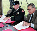
| Lower Lycoming municipal officials sign funding agreements with the County of Lycoming |
 |
| Commissioner Nassberg and Lt. Colonel JT Hand sign the Federal Agreements to initiate the Study |
 |
| Commissioner Burke and Mr Mike Conway sign the State documents of cooperation |
WILLIAMSPORT – Standing beside the waters of the Lycoming Creek, the Deputy Commander of the U.S. Army Corps of Engineers, Baltimore District joined state, county and township officials to formally launch the feasibility study for the flood-prone communities of the Lower Lycoming Creek.
"Initiation of this study represents a significant step toward honoring the commitment we made to these communities after the devastating flood of January 1996" said Commissioner Rebecca Burke. “Today, we have formally committed ourselves to a 36 to 48 month effort that is intended to define the most affordable and effective means for reducing the damages to homes and businesses in this area.”
The study area includes the land lying within the floodplains of the Lycoming Creek within the townships of Lewis, Hepburn, Lycoming, Old Lycoming and Loyalsock. The vulnerable land is close to 5,000 acres and includes the heart of the industrial and commercial zones for the area.
Commenting on the $3.6 million Feasibility Study, Lt. Col. J.T. Hand, deputy commander of U.S. Army Corps of Engineers, Baltimore District stated there would be two phases. Part A—an 18 month effort—is intended to filter a broad range of options and provide project decision makers with the necessary tools to evaluate the list of possible alternatives. Hand indicated that this evaluation will yield a more narrow range of possible implementation alternatives warranting further evaluation. These alternatives will then provide the focus for an expanded evaluation in the 24-30 months slated for Part B.
With the successful implementation this past February of the new Automated Flood Warning System, the U.S. Army Corps of Engineers and the county redoubled their efforts to launch the Lower Lycoming Creek Feasibility Study according to Burke. “Lower Lycoming Creek has seen major flooding damages in 1972, 1975, 1979, 1984, 1994, 1996 and 1997—it’s time to tackle this challenge head on.”
The study area consists of four contiguous “reaches” each with its own unique set of environmental and economic conditions: the Northern Reach, the Heshbon to Hepburnville Reach, the Heshbon Park Reach, and the Southern Old Lycoming Township (OLT) Reach. The Study area stretches from the northern border of Lewis Township to its southernmost point at the confluence of Bottle Run and Lycoming Creek where the Williamsport Levee system begins.
Since the goal of the Feasibility Study is to identify, assess, design and generate alternatives to achieve flood damage reduction in a way that enhances the environment, Pennsylvania Department of Environmental Protection has joined the study team. “We are extremely grateful to have PA DEP partner with us on this project. Their financial and technical assistance will prove invaluable both now and into the future,” said Commissioner Dick Nassberg.
The US Army Corps of Engineers is the official agency of the Federal government responsible for the conduct of Feasibility Studies to determine the technical feasibility and cost effectiveness of flood protection projects. Projects that exhibit a favorable “benefit-to-cost-ratio (BCR)” can advance into construction or implementation. For the Lower Lycoming Creek study, the goal is to determine if a technical solution can be defined, if that solution is affordable to the non-Federal partners, and if that solution has a favorable BCR, where the benefits in anticipated damages reduced outweigh the expected cost of the project.
“This study is all about finding the best means of protecting the homes and property—even the lives—of the citizens of these flood-prone communities,” commented Commissioner Ernie Larson. “This is one of the most vital responsibilities of local government.”